Kyiv launches interactive map of playgrounds with nearby shelters
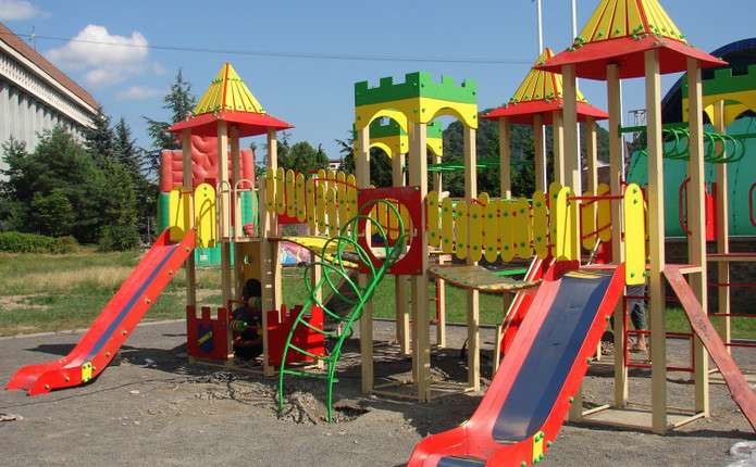
Capital authorities have launched a digital dashboard that allows users to find playgrounds with shelters within a 500-meter radius.
 💡Tech
Photo: tvoemisto.tv
Key points
- Launch of Kyiv's interactive playground dashboard
- Filtering locations by proximity to shelters
- Using open data for urban infrastructure
Kyiv has introduced a new digital tool—an interactive map of the city's playgrounds and sports facilities. Developed by the Main Information and Computing Center, the service transforms open data into a user-friendly platform, helping residents plan safe recreational activities.
Safety and comfort in the urban landscape
A key feature of the service is the ability to filter locations based on the presence of shelters within a 500-meter radius. This allows parents and athletes to assess the safety of a chosen spot in advance. In addition to protective structures, the map provides information on the location of public restrooms and parking zones.
As noted by Dmytro Zahumennyi, Chief of Staff of the Kyiv City State Administration, the project aims to make urban infrastructure more transparent and accessible. Beyond individual residents, the data can be utilized by analysts and developers to improve the urban environment.
It is important to remember: the presence of a shelter on the map does not guarantee it will be open during an air raid alert, so users should verify access in advance.
The city authorities continue to update the dashboard with information provided by specialized departments and district administrations. This initiative marks a step forward in the digitalization of city management, ensuring that every citizen has access to up-to-date information regarding local infrastructure.
Source tvoemisto.tv — tvoemisto.tv/uk/news/13918-de-znayty-dytyachyy-maydanchyk-z-ukryttyam-p… ↗
Read next
 🛡️Security
Healthcare infrastructure recovery in Chernihiv region: over half of facilities restored
In the Chernihiv region, 54% of medical and social facilities damaged by Russian shelling have been restored. The region is also actively working on hospital energy indep…
 🛡️Security
EU to Allocate €1 Billion for Military Equipment for the Armed Forces of Ukraine
The Council of the EU has decided to allocate an additional €1 billion through the European Peace Facility to supply lethal and non-lethal equipment to Ukraine by the end…
 🛡️Security
EU spent more on Russian energy than on support for Ukraine, report finds
According to European Commission data, the amounts paid by EU member states for Russian energy imports have exceeded the financial aid provided to Ukraine since 2022.
 🎓Education
Color Preferences and Intelligence: Insights from Scientific Research
Scientists have investigated the relationship between color preferences, personality types, and cognitive abilities.
 🛡️Security
Russian attack on Zaporizhzhia: kindergarten and residential building damaged
A Russian strike on Zaporizhzhia has caused damage to civilian infrastructure, including a kindergarten and a nearby apartment building.
 🏛️Politics
Ukraine blocks Russian climate report at COP31 over occupied territories data
The Ukrainian delegation at the COP31 climate summit in Antalya successfully blocked a Russian report that included data from occupied Ukrainian territories.